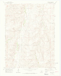
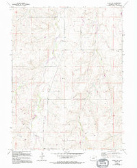
1970 Map of Kiowa NW
USGS Topo · Published 1973About this map
Ebenezer Cem serves as a quiet landmark in this high plains landscape of Elbert County, situated between the north-flowing drainages of Kiowa Creek and Wolf Creek. The area's mid-century ranching and agricultural character is defined by sparse settlements like Whitehead and the presence of localized industrial activity, including a Sandpit and scattered Oil Wells. The terrain is deeply etched by seasonal watercourses such as Dry Creek and several unnamed springs, which dictate the placement of early road networks and property lines. A major Pipeline cuts across the southwestern corner of the quadrangle, reflecting the energy infrastructure development that integrated this rural Colorado region into the broader state economy during the late 1960s and early 1970s.
Find a feature on this map
13 named features on this map. Tap any name to fly to it.
Don’t see what you’re looking for? This feature index may not catch every label — zoom into the map to look around manually.
Map Details
Editions of this 1970 Kiowa NW Map
5 editions found
Other maps of this area

1890 · East Denver
USGS Topo · 1:125,000

1894 · Castle Rock
USGS Topo · 1:125,000

1913 · Castle Rock
USGS Topo · 1:125,000

1939 · Elizabeth
USGS Topo · 1:62,500

1945 · Elizabeth
USGS Topo · 1:62,500

1953 · Denver
USGS Topo · 1:250,000

1955 · Watkins SE
USGS Topo · 1:24,000

1957 · Denver
USGS Topo · 1:250,000

1958 · Denver
USGS Topo · 1:250,000

1960 · Denver
USGS Topo · 1:250,000