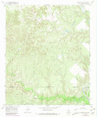
1967 Map of Kiowa Peak NE
USGS Topo · Published 1981About this map
The Brazos River cuts through the southeastern corner of this West Texas landscape, defining the jagged border shared by King and Stonewall Counties. This 1967 survey, with updates from 1979, reveals a terrain shaped by the erosive force of drainage networks including North Croton Creek, Gyp Creek, and Wedington Creek. The industrial presence of the mid-century energy sector is visible through a network of Oil Wells, a Refinery, and a Pipeline that traverses the southern reaches of the quadrangle. Aside from a remote Landing Strip and a few specialized facilities like a Pumping Sta and a Gaging Sta, the area remains largely unpopulated, dominated by natural features such as Smelter Canyon and a prominent rise known as the Hump. This map captures the intersection of deep-cut drainage topography and the infrastructure required to extract resources from the Permian Basin.
Find a feature on this map
18 named features on this map. Tap any name to fly to it.
Don’t see what you’re looking for? This feature index may not catch every label — zoom into the map to look around manually.
Map Details
Editions of this 1967 Kiowa Peak NE Map
2 editions found
Other maps of this area

1954 · Lubbock
USGS Topo · 1:250,000

1954 · Wichita Falls
USGS Topo · 1:250,000

1958 · Wichita Falls
USGS Topo · 1:250,000

1962 · Kiowa Peak
USGS Topo · 1:24,000

1965 · Jud
USGS Topo · 1:24,000

1967 · Cedar Mountain
USGS Topo · 1:24,000

1967 · Dark Canyon
USGS Topo · 1:24,000

1967 · Knox City NW
USGS Topo · 1:24,000

1967 · Kiowa Peak NW
USGS Topo · 1:24,000

1967 · Kiowa Peak NE
USGS Topo · 1:24,000