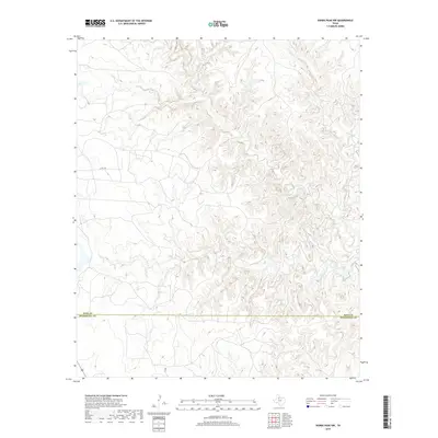
2019 Map of Kiowa Peak NW
USGS Topo · Published 2019About this map
North Croton Creek and its tributary, Big Buffalo Creek, carve a complex drainage system through the northern portion of this 2019 survey, illustrating the deeply dissected topography of the region. The landscape is defined by its rugged watercourses, including the winding path of Pen Branch to the south. Human infrastructure is notably sparse across this terrain, represented primarily by the east-west passage of Co Rd 448 in the western section. The map documents the political boundary between King County and Stonewall County, a line that cuts through the southern reaches of the quadrangle. This detailed topographic study offers a clear look at the watershed patterns and minimal road network as they existed in the late 2010s.
Find a feature on this map
6 named features on this map. Tap any name to fly to it.
Don’t see what you’re looking for? This feature index may not catch every label — zoom into the map to look around manually.
Map Details
Editions of this 2019 Kiowa Peak NW Map
This is the sole edition of this map. No revisions or reprints were ever made.
Other maps of this area

1954 · Lubbock
USGS Topo · 1:250,000

1958 · Lovers Resort
USGS Topo · 1:24,000

1959 · Bob Creek
USGS Topo · 1:24,000

1962 · Kiowa Peak
USGS Topo · 1:24,000

1967 · Dark Canyon
USGS Topo · 1:24,000

1967 · Kiowa Peak NW
USGS Topo · 1:24,000

1967 · Kiowa Peak NE
USGS Topo · 1:24,000
1967 · Buzzard Peak
USGS Topo · 1:24,000

1967 · Kiowa Peak SW
USGS Topo · 1:24,000

1968 · Guthrie
USGS Topo · 1:24,000