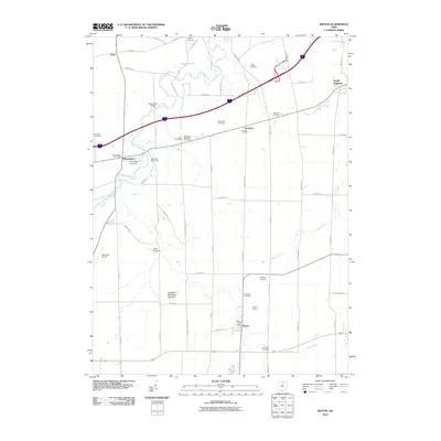
2010 Map of Kipton
USGS Topo · Published 2010About this map
Kipton and Birmingham anchor this western Lorain County landscape, where the winding Vermilion River and Beaver Creek carve through a predominantly agricultural and orchard-heavy region. The map reveals a high concentration of localized cemeteries, such as Rugby Cemetery, Gore Cemetery, and Camden Cemetery, which often mark the sites of early pioneer settlements. Notable horticultural landmarks like Miller Orchards, McDowell Orchards, and the Schoepfle Arboretum emphasize the area's long-standing connection to fruit production and botanical study.
Find a feature on this map
60 named features on this map. Tap any name to fly to it.
Don’t see what you’re looking for? This feature index may not catch every label — zoom into the map to look around manually.
Map Details
Editions of this 2010 Kipton Map
This is the sole edition of this map. No revisions or reprints were ever made.
Other maps of this area

1901 · Oberlin
USGS Topo · 1:62,500

1903 · Vermilion
USGS Topo · 1:62,500

1903 · Oberlin
USGS Topo · 1:62,500

1904 · Wellington
USGS Topo · 1:62,500

1906 · Wellington
USGS Topo · 1:62,500

1908 · New London
USGS Topo · 1:62,500

1956 · Toledo
USGS Topo · 1:250,000

1959 · Berlin Heights
USGS Topo · 1:24,000

1959 · Vermilion East
USGS Topo · 1:24,000

1959 · Vermilion West
USGS Topo · 1:24,000