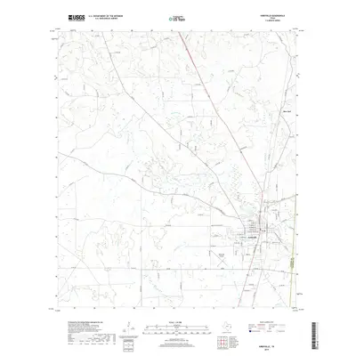
2019 Map of Kirbyville
USGS Topo · Published 2019About this map
Kirbyville serves as the primary hub of this East Texas landscape, where the street grid of the town center transitions into a network of farm-to-market roads and county routes. The town is situated just west of the Jasper Co and Newton Co line, defined by a dense drainage system that includes Pin Oak Creek and Trout Creek. Local history is anchored at the Bean Cem on the eastern edge of town, while the small settlement of Bon Ami lies further north along the Highway 96 corridor.
Find a feature on this map
93 named features on this map. Tap any name to fly to it.
Don’t see what you’re looking for? This feature index may not catch every label — zoom into the map to look around manually.
Map Details
Editions of this 2019 Kirbyville Map
This is the sole edition of this map. No revisions or reprints were ever made.
Other maps of this area

1952 · Lake Charles
USGS Topo · 1:250,000

1954 · Lake Charles
USGS Topo · 1:250,000

1954 · Beaumont
USGS Topo · 1:250,000

1955 · Roganville
USGS Topo · 1:62,500

1955 · Curtis
USGS Topo · 1:62,500

1957 · Beaumont
USGS Topo · 1:250,000

1958 · Spurger
USGS Topo · 1:62,500

1958 · Kirbyville
USGS Topo · 1:62,500

1984 · Beaumont
USGS Topo · 1:250,000

1984 · Potato Patch Lake
USGS Topo · 1:24,000