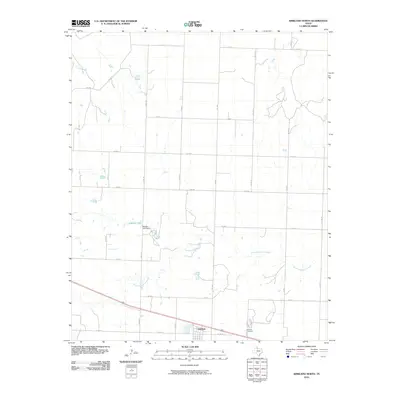
2010 Map of Kirkland North
USGS Topo · Published 2010About this map
Kirkland and its surrounding agricultural landscape are documented in this 2010 survey of Childress County. The settlement is situated in the southern portion of the quadrangle, where a network of Farm to Market roads such as FM 2838 and FM 1033 intersect the grid of county roads. The terrain is defined by the winding path of North Groesbeck Creek, which drains toward the southeast across an otherwise orderly landscape of section lines. To the northwest, Nippert Lake is contained by the Nippert Lake Dam, representing a significant local water management feature in this Texas Panhandle region. Genealogists will find the Kirkland Cemetery noted along the eastern edge of the community, providing a vital point of reference for local family history research in this rural expanse.
Find a feature on this map
22 named features on this map. Tap any name to fly to it.
Don’t see what you’re looking for? This feature index may not catch every label — zoom into the map to look around manually.
Map Details
Editions of this 2010 Kirkland North Map
This is the sole edition of this map. No revisions or reprints were ever made.
Other maps of this area

1954 · Plainview
USGS Topo · 1:250,000

1955 · Lawton
USGS Topo · 1:250,000

1958 · Plainview
USGS Topo · 1:250,000

1960 · Goodlett
USGS Topo · 1:62,500

1960 · Loco
USGS Topo · 1:62,500

1961 · Hollis
USGS Topo · 1:62,500

1967 · Buckle L Ranch
USGS Topo · 1:24,000

1967 · Kirkland South
USGS Topo · 1:24,000

1967 · Kirkland North
USGS Topo · 1:24,000

1967 · Childress
USGS Topo · 1:24,000