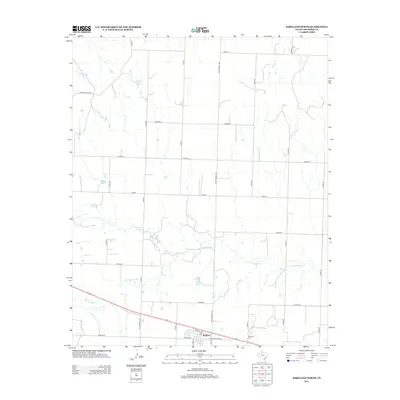
2012 Map of Kirkland North
USGS Topo · Published 2012About this map
Kirkland stands as the primary settlement on this Childress County landscape, with its residential streets like Pennsylvania Ave and Main St providing a structured footprint in an otherwise wide-open agricultural region. The local history of the community is anchored by the Kirkland Cem, located just east of the town center. The surrounding terrain is defined by the wandering path of N Groesbeck Cr, which cuts through the southern half of the map, and the isolated waters of Nippert Lake to the west. This 2012 survey illustrates a classic Panhandle rural grid, where an extensive network of county roads, including Co Road U and Co Road Y, connects disparate farmsteads to thoroughfares such as FM-268 and Ranch Road 1033. The geography reflects a late twentieth-century persistence of small-town Texas life centered on land and lineage.
Find a feature on this map
26 named features on this map. Tap any name to fly to it.
Don’t see what you’re looking for? This feature index may not catch every label — zoom into the map to look around manually.
Map Details
Editions of this 2012 Kirkland North Map
This is the sole edition of this map. No revisions or reprints were ever made.
Other maps of this area

1954 · Plainview
USGS Topo · 1:250,000

1955 · Lawton
USGS Topo · 1:250,000

1958 · Plainview
USGS Topo · 1:250,000

1960 · Goodlett
USGS Topo · 1:62,500

1960 · Loco
USGS Topo · 1:62,500

1961 · Hollis
USGS Topo · 1:62,500

1967 · Buckle L Ranch
USGS Topo · 1:24,000

1967 · Kirkland South
USGS Topo · 1:24,000

1967 · Kirkland North
USGS Topo · 1:24,000

1967 · Childress
USGS Topo · 1:24,000