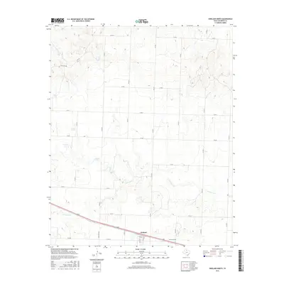
2016 Map of Kirkland North
USGS Topo · Published 2016About this map
Kirkland serves as the primary focal point of this Childress County landscape, situated where the grid of rural farm roads meets the more modern infrastructure of the 21st century. The map illustrates a transitional terrain defined by the winding course of N Groesbeck Cr and the localized catchment of Nippert Lake. This area of north Texas maintains a sparse, agrarian character, with significant land use organized around an extensive network of county roads like Co RD S and Co RD 25. For genealogists and local researchers, the Kirkland Cem provides a tangible link to the community's heritage, located south of the main settlement. The presence of state-maintained routes such as FM 1033 and FM 268 underscores the continued importance of regional connectivity for the isolated homesteads and ranching operations that dot this high plains environment.
Find a feature on this map
24 named features on this map. Tap any name to fly to it.
Don’t see what you’re looking for? This feature index may not catch every label — zoom into the map to look around manually.
Map Details
Editions of this 2016 Kirkland North Map
This is the sole edition of this map. No revisions or reprints were ever made.
Other maps of this area

1954 · Plainview
USGS Topo · 1:250,000

1955 · Lawton
USGS Topo · 1:250,000

1958 · Plainview
USGS Topo · 1:250,000

1960 · Goodlett
USGS Topo · 1:62,500

1960 · Loco
USGS Topo · 1:62,500

1961 · Hollis
USGS Topo · 1:62,500

1967 · Buckle L Ranch
USGS Topo · 1:24,000

1967 · Kirkland South
USGS Topo · 1:24,000

1967 · Kirkland North
USGS Topo · 1:24,000

1967 · Childress
USGS Topo · 1:24,000