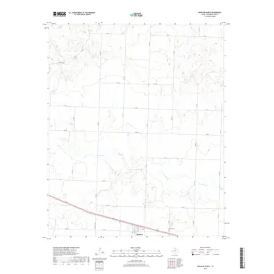
2019 Map of Kirkland North
USGS Topo · Published 2019About this map
Kirkland serves as the primary settlement on this High Plains map, situated at the southern edge of the quadrangle. The community's local history is anchored by the Kirkland Cem, which sits just east of the main town area. The landscape is defined by the winding course of N Groesbeck Cr, which cuts across the central and southern portions of the sheet, providing vital drainage and topography to an otherwise grid-patterned agricultural region. To the northwest, Nippert Lake stands out as a distinct water feature amidst the expansive network of county and ranch roads. The infrastructure reflects a classic Texas Panhandle layout, where a dense system of roads like FM 1033 and FM 268 connect various agricultural tracts and ranching outposts, tracing the progress of rural development and land use into the twenty-first century.
Find a feature on this map
24 named features on this map. Tap any name to fly to it.
Don’t see what you’re looking for? This feature index may not catch every label — zoom into the map to look around manually.
Map Details
Editions of this 2019 Kirkland North Map
This is the sole edition of this map. No revisions or reprints were ever made.
Other maps of this area

1954 · Plainview
USGS Topo · 1:250,000

1955 · Lawton
USGS Topo · 1:250,000

1958 · Plainview
USGS Topo · 1:250,000

1960 · Goodlett
USGS Topo · 1:62,500

1960 · Loco
USGS Topo · 1:62,500

1961 · Hollis
USGS Topo · 1:62,500

1967 · Buckle L Ranch
USGS Topo · 1:24,000

1967 · Kirkland South
USGS Topo · 1:24,000

1967 · Kirkland North
USGS Topo · 1:24,000

1967 · Childress
USGS Topo · 1:24,000