
1938 Map of Kirksville
USGS Topo · Published 1938About this map
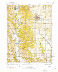
The Chariton River carves a winding path through the western half of this 1938 landscape, anchoring a rural network of small agricultural settlements and family-named landmarks. The city of Kirksville stands as the primary hub, showing a concentrated grid of streets and the Landing Field to its southeast. This pre-war era reveals a high density of rural schoolhouses, such as Illinois Bend Sch and Danforth Sch, placed at nearly every major intersection to serve a dispersed farming population.
Find a feature on this map
69 named features on this map. Tap any name to fly to it.
Don’t see what you’re looking for? This feature index may not catch every label — zoom into the map to look around manually.
Map Details
Editions of this 1938 Kirksville Map
2 editions found
Other maps of this area

1903 · Edina
USGS Topo · 1:125,000

1908 · Atlanta
USGS Topo · 1:62,500

1911 · Queen City
USGS Topo · 1:62,500

1912 · Green City
USGS Topo · 1:62,500

1913 · Queen City
USGS Topo · 1:62,500

1914 · Green City
USGS Topo · 1:62,500

1937 · Elmer
USGS Topo · 1:48,000

1940 · Kirksville
USGS Topo · 1:62,500

1942 · Elmer
USGS Topo · 1:62,500

1951 · New Boston
USGS Topo · 1:24,000