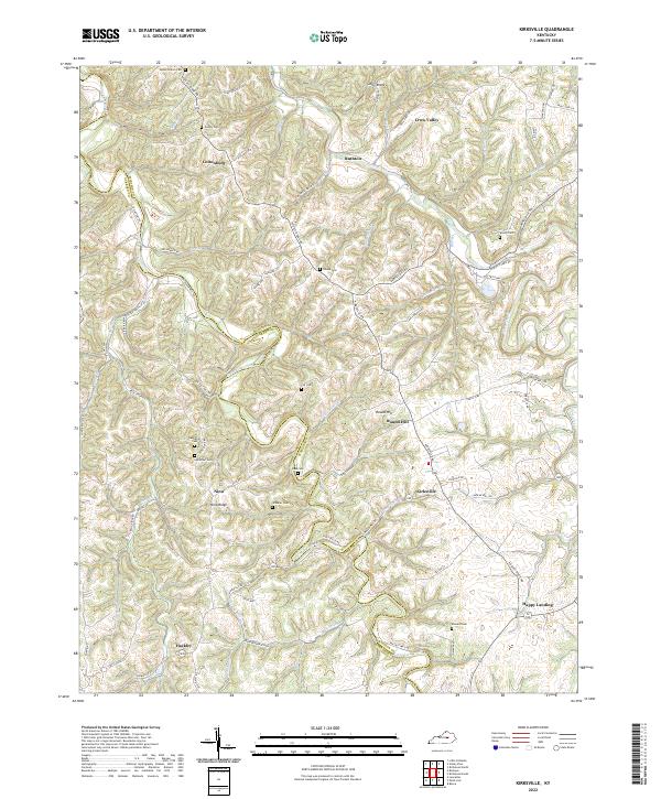
2022 Map of Kirksville
USGS Topo · Published 2022About this map
Kirksville and the surrounding rural communities of Cottonburg and Hackley anchor this detailed study of the Central Kentucky landscape. The topography is defined by the winding course of Silver Creek and the long, high ridges of Jolly Ridge and Nina Ridge, which dictate the placement of local roads and family-named landmarks. The border between Madison Co and Garrard Co bisects the terrain, tracing through farm lanes and creek beds. For genealogists and local historians, the abundance of small family burial grounds is particularly significant, including the Salem Church Cem, Gilead Cem, and Kinnard Cem. These sites, alongside settlements like Happy Landing and Nina, reflect a pattern of development where social and spiritual life followed the natural drainage of Point Lick Creek and its many branches.
Find a feature on this map
80 named features on this map. Tap any name to fly to it.
Don’t see what you’re looking for? This feature index may not catch every label — zoom into the map to look around manually.
Map Details
Editions of this 2022 Kirksville Map
This is the sole edition of this map. No revisions or reprints were ever made.
Other maps of this area

1892 · Richmond
USGS Topo · 1:125,000

1897 · Richmond
USGS Topo · 1:125,000

1905 · Harrodsburg
USGS Topo · 1:125,000

1952 · Berea
USGS Topo · 1:24,000

1952 · Valley View
USGS Topo · 1:24,000

1952 · Little Hickman
USGS Topo · 1:24,000

1952 · Buckeye
USGS Topo · 1:24,000

1952 · Paint Lick
USGS Topo · 1:24,000

1952 · Lancaster
USGS Topo · 1:24,000

1952 · Kirksville
USGS Topo · 1:24,000