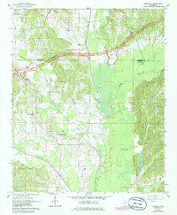
1965 Map of Kirkville
USGS Topo · Published 1986About this map
Natchez Trace Parkway cuts across this northeastern Mississippi landscape, with a significant section marked as a Proposed Location as the modern scenic route was being established. The terrain is defined by the winding course of the Tombigbee River and the convergence of several major waterways, including Donivan Creek, Twentymile Creek, and Mackeys Creek. These river bottoms and creeks shaped the early development of the rural communities found here, such as Kirkville and Marietta.
Find a feature on this map
28 named features on this map. Tap any name to fly to it.
Don’t see what you’re looking for? This feature index may not catch every label — zoom into the map to look around manually.
Map Details
Editions of this 1965 Kirkville Map
2 editions found

Other maps of this area

1921 · Booneville
USGS Topo · 1:48,000

1921 · Tupelo
USGS Topo · 1:48,000

1922 · Booneville
USGS Topo · 1:62,500

1923 · Tupelo
USGS Topo · 1:62,500

1956 · Tupelo
USGS Topo · 1:250,000

1958 · Tupelo
USGS Topo · 1:250,000

1965 · Mooreville
USGS Topo · 1:24,000
1965 · Paden SE
USGS Topo · 1:24,000

1965 · Fulton SE
USGS Topo · 1:24,000

1965 · Fulton
USGS Topo · 1:24,000