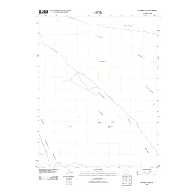
2010 Map of Klondike Bluffs
USGS Topo · Published 2010About this map
Arches National Park dominates this desert landscape, characterized by a concentration of world-renowned geological formations. Distinctive natural landmarks such as Tower Arch, Parallel Arch, and the Marching Men are documented along the northwestern reaches of the park boundary. The map follows the progression of Salt Valley and the Salt Valley Wash as they cut through the terrain, flanked by the Klondike Bluffs and the eastern edge of Devils Garden, where the Dark Angel spire stands sentinel.
Find a feature on this map
22 named features on this map. Tap any name to fly to it.
Don’t see what you’re looking for? This feature index may not catch every label — zoom into the map to look around manually.
Map Details
Editions of this 2010 Klondike Bluffs Map
This is the sole edition of this map. No revisions or reprints were ever made.
Other maps of this area

1885 · La Sal
USGS Topo · 1:250,000

1951 · The Knoll
USGS Topo · 1:62,500

1952 · Moab 4 NW
USGS Topo · 1:24,000

1952 · Moab 3 NE
USGS Topo · 1:24,000

1956 · Moab
USGS Topo · 1:250,000

1958 · Crescent Junction
USGS Topo · 1:62,500

1958 · Thompson
USGS Topo · 1:62,500

1959 · Moab
USGS Topo · 1:250,000
1959 · Moab
USGS Topo · 1:62,500
1959 · Moab 4 NE
USGS Topo · 1:24,000