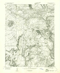
1959 Map of Moab 4 NE
USGS Topo · Published 1961About this map
Arches National Monument dominates this 1959 topographic survey, revealing the intricate geological formations of the high desert before modern tourism infrastructure fully transformed the landscape. The map highlights iconic landmarks like Balanced Rock and the complex cluster of The Windows, which includes North-South Window and Turret Arch. To the north, the labyrinthine Fiery Furnace sits between the seasonal drainage of Salt Valley and Salt Valley Wash.
Find a feature on this map
23 named features on this map. Tap any name to fly to it.
Don’t see what you’re looking for? This feature index may not catch every label — zoom into the map to look around manually.
Map Details
Editions of this 1959 Moab 4 NE Map
This is the sole edition of this map. No revisions or reprints were ever made.
Other maps of this area

1885 · La Sal
USGS Topo · 1:250,000

1952 · Moab 4 NW
USGS Topo · 1:24,000

1952 · Moab 4 SW
USGS Topo · 1:24,000

1954 · Mt. Waas 3 NW
USGS Topo · 1:24,000

1954 · Mt. Waas 3 SW
USGS Topo · 1:24,000

1954 · Castle Valley
USGS Topo · 1:62,500

1956 · Moab
USGS Topo · 1:250,000

1958 · Thompson
USGS Topo · 1:62,500

1958 · Cisco
USGS Topo · 1:62,500

1959 · Moab
USGS Topo · 1:250,000