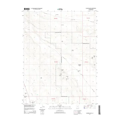
2014 Map of Klondike Bluffs
USGS Topo · Published 2014About this map
Arches National Park dominates this desert landscape, where wind and water have carved a concentration of unique geological formations within the high plateaus of Grand County. The map details a labyrinth of sandstone fins and arches, including the prominent Marching Men and the towering Dark Angel pillar. Local landmarks such as Tower Arch, Parallel Arch, and Anniversary Arch are precisely plotted, showing the concentration of these features along the Klondike Bluffs.
Find a feature on this map
30 named features on this map. Tap any name to fly to it.
Don’t see what you’re looking for? This feature index may not catch every label — zoom into the map to look around manually.
Map Details
Editions of this 2014 Klondike Bluffs Map
This is the sole edition of this map. No revisions or reprints were ever made.
Other maps of this area

1885 · La Sal
USGS Topo · 1:250,000

1951 · The Knoll
USGS Topo · 1:62,500

1952 · Moab 4 NW
USGS Topo · 1:24,000

1952 · Moab 3 NE
USGS Topo · 1:24,000

1956 · Moab
USGS Topo · 1:250,000

1958 · Crescent Junction
USGS Topo · 1:62,500

1958 · Thompson
USGS Topo · 1:62,500

1959 · Moab
USGS Topo · 1:250,000
1959 · Moab
USGS Topo · 1:62,500
1959 · Moab 4 NE
USGS Topo · 1:24,000