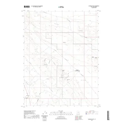
2020 Map of Klondike Bluffs
USGS Topo · Published 2020About this map
Arches National Park dominates the southeastern quadrant of this terrain, where a concentration of named sandstone formations highlights the region's geological character. This landscape is defined by its dramatic relief, featuring prominent landmarks such as Tower Arch, Parallel Arch, and Anniversary Arch. The northern reaches are marked by Salt Valley Gorge and the curious Utahraptor Ridge, while the western expanse transitions into the level reaches of Klondike Flat.
Find a feature on this map
25 named features on this map. Tap any name to fly to it.
Don’t see what you’re looking for? This feature index may not catch every label — zoom into the map to look around manually.
Map Details
Editions of this 2020 Klondike Bluffs Map
This is the sole edition of this map. No revisions or reprints were ever made.
Other maps of this area

1885 · La Sal
USGS Topo · 1:250,000

1951 · The Knoll
USGS Topo · 1:62,500

1952 · Moab 4 NW
USGS Topo · 1:24,000

1952 · Moab 3 NE
USGS Topo · 1:24,000

1956 · Moab
USGS Topo · 1:250,000

1958 · Crescent Junction
USGS Topo · 1:62,500

1958 · Thompson
USGS Topo · 1:62,500

1959 · Moab
USGS Topo · 1:250,000
1959 · Moab
USGS Topo · 1:62,500
1959 · Moab 4 NE
USGS Topo · 1:24,000