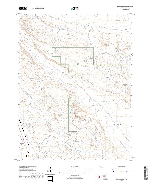
2023 Map of Klondike Bluffs
USGS Topo · Published 2023About this map
Arches National Park dominates the eastern half of this landscape, showcasing a high concentration of named geologic formations including Tower Arch, Parallel Arch, and Anniversary Arch. The northern reaches of the park boundary encompass Eagle Park, while the terrain to the west transitions into the broad expanse of Klondike Flat. A network of unpaved corridors like Salt Valley Road and the Tower Arch Trailhead Road provides the primary access through this remote desert environment, following natural drainage patterns like Salt Valley Wash.
Find a feature on this map
22 named features on this map. Tap any name to fly to it.
Don’t see what you’re looking for? This feature index may not catch every label — zoom into the map to look around manually.
Map Details
Editions of this 2023 Klondike Bluffs Map
This is the sole edition of this map. No revisions or reprints were ever made.
Other maps of this area

1885 · La Sal
USGS Topo · 1:250,000

1951 · The Knoll
USGS Topo · 1:62,500

1952 · Moab 4 NW
USGS Topo · 1:24,000

1952 · Moab 3 NE
USGS Topo · 1:24,000

1956 · Moab
USGS Topo · 1:250,000

1958 · Crescent Junction
USGS Topo · 1:62,500

1958 · Thompson
USGS Topo · 1:62,500

1959 · Moab
USGS Topo · 1:250,000
1959 · Moab
USGS Topo · 1:62,500
1959 · Moab 4 NE
USGS Topo · 1:24,000