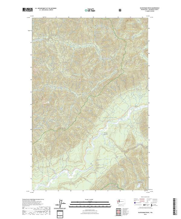
2023 Map of Kloochman Rock
USGS Topo · Published 2023About this map
Kloochman Rock stands as a prominent landmark within the deeply incised topography of the western Olympic Mountains. This 2023 survey documents the convergence of several major water systems, including the Queets River, the Solleks River, and the Clearwater River. The map illustrates a landscape primarily defined by administrative conservation boundaries, where the Olympic National Park meets the Olympic Wilderness and the Olympic National Forest. Human passage through this dense terrain is largely limited to the Queets River Trl, which tracks the river's path through the southern portion of the quadrangle. Small-scale features like Lake Billy and numerous named tributaries such as Harlow Creek and Tshletshy Creek reveal the intricate drainage patterns of the peninsula's rainforest interior. The presence of numerous land blocks, such as PB 42 and PB 49, indicates the complex land ownership and survey history within these protected federal lands.
Find a feature on this map
28 named features on this map. Tap any name to fly to it.
Don’t see what you’re looking for? This feature index may not catch every label — zoom into the map to look around manually.
Map Details
Editions of this 2023 Kloochman Rock Map
This is the sole edition of this map. No revisions or reprints were ever made.
Other maps of this area

1939 · Mount Tom
USGS Topo · 1:62,500

1943 · Spruce Mountain
USGS Topo · 1:62,500

1943 · Copalis Beach
USGS Topo · 1:250,000

1951 · Copalis Beach
USGS Topo · 1:250,000

1956 · Kloochman Rock
USGS Topo · 1:62,500

1956 · Mount Tom
USGS Topo · 1:62,500

1956 · Spruce Mtn.
USGS Topo · 1:62,500

1956 · Salmon River
USGS Topo · 1:62,500
1957 · Mount Tom
USGS Topo · 1:62,500

1957 · Copalis Beach
USGS Topo · 1:250,000