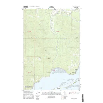
2017 Map of Knappton
USGS Topo · Published 2017About this map
The Naselle River dominates this Pacific County landscape as it winds through the timbered heights of Bear River Ridge and Naselle Ridge before reaching the broad waters of the Columbia River. The settlement of Naselle serves as the inland hub, while the riverbank reveals the older riverside footprints of Knappton and Frankfort. This coastal region is defined by the transitions between upland forests and the tidal influence of the Columbia, with specialized features like Wirkkala Airport and Peaceful Hill Cem reflecting the local community's development. Along the southern shoreline, the Lewis and Clark National Historical Park preserves the cultural significance of the area near Megler, where prominent landmarks such as Grays Point and Portuguese Point reach into the estuary.
Find a feature on this map
48 named features on this map. Tap any name to fly to it.
Don’t see what you’re looking for? This feature index may not catch every label — zoom into the map to look around manually.
Map Details
Editions of this 2017 Knappton Map
This is the sole edition of this map. No revisions or reprints were ever made.
Other maps of this area

1919 · Astoria
USGS Topo · 1:62,500

1938 · Fort Columbia
USGS Topo · 1:62,500

1939 · Astoria
USGS Topo · 1:62,500

1940 · Svensen
USGS Topo · 1:62,500

1940 · Brookfield
USGS Topo · 1:62,500

1943 · Fort Columbia
USGS Topo · 1:62,500

1949 · Astoria
USGS Topo · 1:24,000

1949 · Chinook
USGS Topo · 1:24,000

1949 · Upper Naselle River
USGS Topo · 1:24,000

1949 · Oman Ranch
USGS Topo · 1:24,000