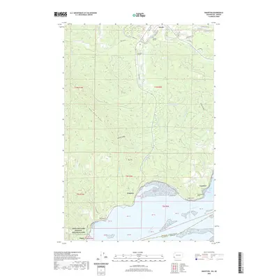
2020 Map of Knappton
USGS Topo · Published 2020About this map
Naselle serves as the focal point of this coastal landscape, situated near the northern reaches where the Naselle River and its south fork wind through the timbered terrain. The topography is defined by prominent elevations such as Bear River Ridge and Naselle Ridge, which descend toward the wide expanse of the Columbia River and Grays Bay at the southern boundary. Along these shores, the small settlements of Knappton and Frankfort mark the historic interface between the river's maritime activity and the surrounding hills.
Find a feature on this map
62 named features on this map. Tap any name to fly to it.
Don’t see what you’re looking for? This feature index may not catch every label — zoom into the map to look around manually.
Map Details
Editions of this 2020 Knappton Map
This is the sole edition of this map. No revisions or reprints were ever made.
Other maps of this area

1919 · Astoria
USGS Topo · 1:62,500

1938 · Fort Columbia
USGS Topo · 1:62,500

1939 · Astoria
USGS Topo · 1:62,500

1940 · Svensen
USGS Topo · 1:62,500

1940 · Brookfield
USGS Topo · 1:62,500

1943 · Fort Columbia
USGS Topo · 1:62,500

1949 · Astoria
USGS Topo · 1:24,000

1949 · Chinook
USGS Topo · 1:24,000

1949 · Upper Naselle River
USGS Topo · 1:24,000

1949 · Oman Ranch
USGS Topo · 1:24,000