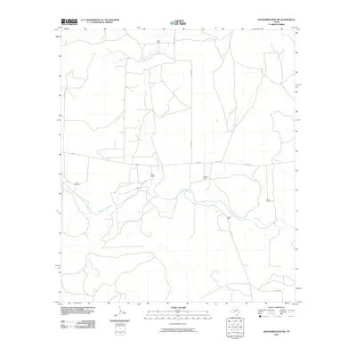
2010 Map of Knickerbocker NW
USGS Topo · Published 2010About this map
The Middle Concho River winds through this West Texas landscape, serving as a primary geographic anchor for the region's established ranching operations. The area is defined by its wide-ranging pastoral properties, including the Mayer Ranch to the west and the Kelly Ranch to the east. The terrain is further dissected by seasonal waterways such as East Rocky Creek and Brushy Creek, which join the river system amidst a network of rural routes like Arden Rd and N Burma Rd.
Find a feature on this map
15 named features on this map. Tap any name to fly to it.
Don’t see what you’re looking for? This feature index may not catch every label — zoom into the map to look around manually.
Map Details
Editions of this 2010 Knickerbocker NW Map
This is the sole edition of this map. No revisions or reprints were ever made.
Other maps of this area

1895 · Sherwood
USGS Topo · 1:125,000

1924 · Sherwood 1-d
USGS Topo · 1:48,000

1924 · Sherwood 1-a
USGS Topo · 1:48,000

1928 · Tankersly
USGS Topo · 1:62,500

1954 · San Angelo
USGS Topo · 1:250,000

1957 · Carlsbad
USGS Topo · 1:62,500

1957 · Twin Buttes
USGS Topo · 1:24,000

1957 · Knickerbocker
USGS Topo · 1:62,500

1957 · Mount Nebo
USGS Topo · 1:24,000

1958 · San Angelo
USGS Topo · 1:250,000