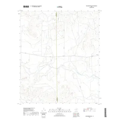
2019 Map of Knickerbocker NW
USGS Topo · Published 2019About this map
The Middle Concho River winds through this West Texas landscape, marking the transition between the rolling uplands of Tom Green and Irion counties. The 2019 survey documents a landscape defined by significant drainage systems, including E Rocky Cr and Brushy Cr, which cut through the high ground. Local history is anchored by the Midway Cem located in the eastern portion of the quadrangle along Arden Rd. The map reveals a network of rural routes such as Mims Rd, Tullos Rd, and the distinctively named N Burma Rd and S Burma Rd. These roads often follow the natural contours of the terrain or historical property lines, providing a clear view of land use and family holdings in this ranching country. The presence of the Irion Co Tom Green Co boundary line running vertically through the center provides essential context for researchers tracing property across county lines.
Find a feature on this map
14 named features on this map. Tap any name to fly to it.
Don’t see what you’re looking for? This feature index may not catch every label — zoom into the map to look around manually.
Map Details
Editions of this 2019 Knickerbocker NW Map
This is the sole edition of this map. No revisions or reprints were ever made.
Other maps of this area

1895 · Sherwood
USGS Topo · 1:125,000

1924 · Sherwood 1-d
USGS Topo · 1:48,000

1924 · Sherwood 1-a
USGS Topo · 1:48,000

1928 · Tankersly
USGS Topo · 1:62,500

1954 · San Angelo
USGS Topo · 1:250,000

1957 · Carlsbad
USGS Topo · 1:62,500

1957 · Twin Buttes
USGS Topo · 1:24,000

1957 · Knickerbocker
USGS Topo · 1:62,500

1957 · Mount Nebo
USGS Topo · 1:24,000

1958 · San Angelo
USGS Topo · 1:250,000