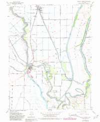
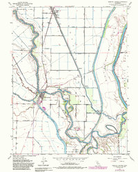
1952 Map of Knights Landing
USGS Topo · Published 1981About this map
Sacramento River meanders define this Central Valley landscape, where complex water management infrastructure meets established agricultural settlements. The town of Knights Landing serves as a focal point, situated at a critical bend where the river meets the Knights Landing Ridge Cut. This engineering work, alongside the massive Sutter By-Pass to the east, illustrates the region's historic efforts to control seasonal flooding. Small communities like Robbins and Marchant dot the surrounding reclamation districts, supported by an intricate network of levees including the Sutter Levee and Yolo Levee.
Find a feature on this map
41 named features on this map. Tap any name to fly to it.
Don’t see what you’re looking for? This feature index may not catch every label — zoom into the map to look around manually.
Map Details
Editions of this 1952 Knights Landing Map
5 editions found
Other maps of this area

1907 · Dunnigan
USGS Topo · 1:62,500

1907 · Woodland
USGS Topo · 1:62,500

1907 · Davisville
USGS Topo · 1:62,500

1910 · Knights Landing
USGS Topo · 1:31,680

1910 · Vernon
USGS Topo · 1:31,680

1910 · Nicolaus
USGS Topo · 1:31,680

1910 · Marcuse
USGS Topo · 1:31,680

1915 · Yolo
USGS Topo · 1:31,680

1915 · Ronda
USGS Topo · 1:31,680
1915 · Kirkville
USGS Topo · 1:31,680