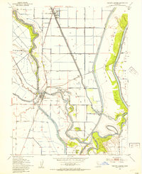
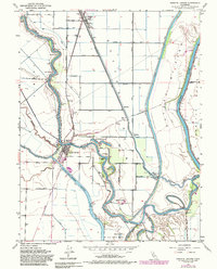
1952 Map of Knights Landing
USGS Topo · Published 1984About this map
The Sacramento River and Feather River converge at the center of this 1952 study, revealing a complex landscape of water management and river navigation. The town of Knights Landing serves as the primary hub, where the Southern Pacific railroad crosses the water and the local Cem and Knights School anchor the community's early mid-century layout. The map documents an era of significant reclamation, notably within Reclamation District No 1500, which transformed this flood-prone region into productive agricultural land.
Find a feature on this map
41 named features on this map. Tap any name to fly to it.
Don’t see what you’re looking for? This feature index may not catch every label — zoom into the map to look around manually.
Map Details
Editions of this 1952 Knights Landing Map
5 editions found
Other maps of this area

1907 · Dunnigan
USGS Topo · 1:62,500

1907 · Woodland
USGS Topo · 1:62,500

1907 · Davisville
USGS Topo · 1:62,500

1910 · Knights Landing
USGS Topo · 1:31,680

1910 · Vernon
USGS Topo · 1:31,680

1910 · Nicolaus
USGS Topo · 1:31,680

1910 · Marcuse
USGS Topo · 1:31,680

1915 · Yolo
USGS Topo · 1:31,680

1915 · Ronda
USGS Topo · 1:31,680
1915 · Kirkville
USGS Topo · 1:31,680