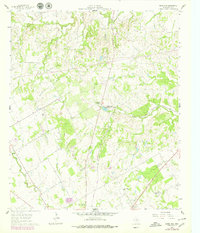
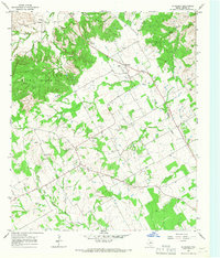
1961 Map of Knob Hill
USGS Topo · Published 1979About this map
The North Paluxy River and South Paluxy River converge in this Erath County landscape, which reflects a mid-century transition from traditional rural life to institutional research and modern infrastructure. Rural education and community hubs are anchored by Center Grove Sch and Smith Springs Sch, while the presence of the Texas A & M College Experimental Station in the south points toward the region's agricultural scientific interests. The local geography is marked by several burial grounds including Morton Chapel Cem and Knob Hill Cem, situated near its namesake Knob Hill landmark. Transportation and commerce are represented by the Atchison Topeka and Santa Fe railroad, which cuts through the terrain alongside newer developments like the Stephenville Country Club Lake and a prominent Landing Strip.
Find a feature on this map
22 named features on this map. Tap any name to fly to it.
Don’t see what you’re looking for? This feature index may not catch every label — zoom into the map to look around manually.
Map Details
Editions of this 1961 Knob Hill Map
3 editions found
Other maps of this area

1890 · Stephenville
USGS Topo · 1:125,000

1920 · Stephenville
USGS Topo · 1:125,000

1954 · Abilene
USGS Topo · 1:250,000

1958 · Abilene
USGS Topo · 1:250,000

1961 · Johnsville
USGS Topo · 1:24,000

1961 · Knob Hill
USGS Topo · 1:24,000

1961 · Stephenville
USGS Topo · 1:24,000
1965 · Bluff Dale NE
USGS Topo · 1:24,000
1965 · Bunyan
USGS Topo · 1:24,000
1965 · Huckabay
USGS Topo · 1:24,000