
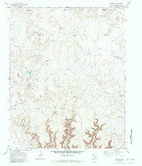
1971 Map of Knoblaw
USGS Topo · Published 1973About this map
Water management dominates the high plains landscape across the Hartley and Oldham county line in the early 1970s. This survey records an intricate network of livestock water sources essential for cattle ranching in the Texas Panhandle, ranging from natural features like Chisum Spring to man-made infrastructure such as the Thousand Dollar Dam. The topography is defined by the incision of Chisum Canyon and the winding course of Horse Creek, which cut through the level terrain near the prominent elevation of Knoblaw.
Find a feature on this map
24 named features on this map. Tap any name to fly to it.
Don’t see what you’re looking for? This feature index may not catch every label — zoom into the map to look around manually.
Map Details
Editions of this 1971 Knoblaw Map
2 editions found
Other maps of this area

1954 · Tucumcari
USGS Topo · 1:250,000

1958 · Tucumcari
USGS Topo · 1:250,000

1966 · Vat Camp
USGS Topo · 1:24,000

1966 · Trujillo Camp
USGS Topo · 1:24,000

1968 · Sanchez Springs
USGS Topo · 1:24,000

1971 · Romero SE
USGS Topo · 1:24,000

1971 · Doyle Hill
USGS Topo · 1:24,000

1971 · Nara Visa
USGS Topo · 1:24,000

1971 · Spring Creek Ranch
USGS Topo · 1:24,000
1971 · Romero
USGS Topo · 1:24,000