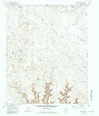
1971 Map of Knoblaw
USGS Topo · Published 1982About this map
Horse Creek and Minneosa Creek carve through the high plains of the Texas Panhandle along the border of Hartley and Oldham counties. This ranching landscape is defined by its water infrastructure, showing a sophisticated network of improvements designed to support livestock in an arid environment. Named features like Thousand Dollar Dam and the South Santa Fe Windmill reflect the investment and labor required to manage the land.
Find a feature on this map
22 named features on this map. Tap any name to fly to it.
Don’t see what you’re looking for? This feature index may not catch every label — zoom into the map to look around manually.
Map Details
Editions of this 1971 Knoblaw Map
2 editions found
Other maps of this area

1954 · Tucumcari
USGS Topo · 1:250,000

1958 · Tucumcari
USGS Topo · 1:250,000

1966 · Vat Camp
USGS Topo · 1:24,000

1966 · Trujillo Camp
USGS Topo · 1:24,000

1968 · Sanchez Springs
USGS Topo · 1:24,000

1971 · Romero SE
USGS Topo · 1:24,000

1971 · Doyle Hill
USGS Topo · 1:24,000

1971 · Nara Visa
USGS Topo · 1:24,000

1971 · Knoblaw
USGS Topo · 1:24,000

1971 · Spring Creek Ranch
USGS Topo · 1:24,000