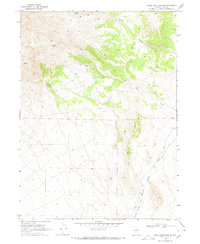
1968 Map of Knoll Mountain SE
USGS Topo · Published 1972About this map
Thousand Springs Valley defines the lower elevations of this high-desert landscape in northeastern Nevada, where drainage patterns from the surrounding uplands converge. The topographical detail reveals a complex network of ephemeral waterways, notably Burnt Creek and the deep incision of Corral Canyon. This 1968 field-checked environment is characterized by its vital water sources, including several identified Springs and an isolated Spring that would have been critical markers for ranching and movement through the basin. The presence of a Jeep Trail winding through the northern terrain indicates the remote accessibility of the region during the late 1960s. Benchmarks like BM 5343 and BM 5364 provide precise elevation data for the valley floor, documenting the geographic bones of this Elko County interior.
Find a feature on this map
12 named features on this map. Tap any name to fly to it.
Don’t see what you’re looking for? This feature index may not catch every label — zoom into the map to look around manually.
Map Details
Editions of this 1968 Knoll Mountain SE Map
2 editions found
Other maps of this area

1955 · Wells
USGS Topo · 1:250,000

1958 · Wells
USGS Topo · 1:250,000

1961 · Wells
USGS Topo · 1:250,000

1961 · Delano Mountains
USGS Topo · 1:62,500

1967 · Ninemile Mtn
USGS Topo · 1:24,000

1968 · Knoll Mountain
USGS Topo · 1:24,000

1968 · Knoll Mountain SE
USGS Topo · 1:24,000

1968 · Wine Cup Ranch
USGS Topo · 1:24,000

1968 · Blanchard Mtn
USGS Topo · 1:24,000

1968 · Texas Spring
USGS Topo · 1:24,000