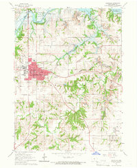
1965 Map of Knoxville
USGS Topo · Published 1966About this map
The city of Knoxville dominates this mid-1960s landscape, serving as a hub for both public institutions and transportation. Significant landmarks such as the VA Hospital and County Fairground underscore the town's regional role, while the presence of the Courthouse marks it as the county seat. The surrounding countryside is defined by the early stages of Lake Red Rock, shown here at its normal pool elevation of 725 feet along the White Breast Creek and Des Moines River valley.
Find a feature on this map
41 named features on this map. Tap any name to fly to it.
Don’t see what you’re looking for? This feature index may not catch every label — zoom into the map to look around manually.
Map Details
Editions of this 1965 Knoxville Map
2 editions found
Other maps of this area

1909 · Knoxville
USGS Topo · 1:62,500

1910 · Pella
USGS Topo · 1:62,500

1912 · Knoxville
USGS Topo · 1:62,500

1912 · Pella
USGS Topo · 1:62,500

1924 · Melcher
USGS Topo · 1:62,500

1929 · Albia
USGS Topo · 1:62,500

1954 · Des Moines
USGS Topo · 1:250,000

1956 · Des Moines
USGS Topo · 1:250,000

1957 · Des Moines
USGS Topo · 1:250,000

1965 · Knoxville NW
USGS Topo · 1:24,000