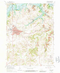
1965 Map of Knoxville
USGS Topo · Published 1989About this map
Knoxville serves as the focal point of this mid-1960s Iowa survey, showing the city's infrastructure from the central Courthouse and VA Hospital to the County Fairground. The industrial landscape is defined by extensive surface mining, with numerous Strip Mine and Strip Mines locations clustered around Flagler and south towards Pershing. These operations follow the local topography between the drainage of Competine Creek and English Creek. Transportation networks are heavily represented by the Chicago and North Western Railroad and the Burlington And Norfolk lines, which supported the movement of coal and agricultural goods. To the north, the rising waters of Lake Red Rock and the channel of White Breast Creek illustrate the managed hydrology of the Des Moines River valley. Numerous rural burial sites, such as Asbury Cem and Overton Cem, provide specific points of interest for genealogical research across the Indiana and Knoxville townships.
Find a feature on this map
36 named features on this map. Tap any name to fly to it.
Don’t see what you’re looking for? This feature index may not catch every label — zoom into the map to look around manually.
Map Details
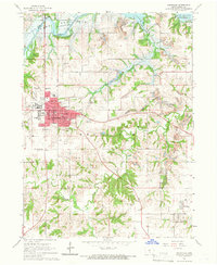
Editions of this 1965 Knoxville Map
2 editions found
Other maps of this area

1909 · Knoxville
USGS Topo · 1:62,500

1910 · Pella
USGS Topo · 1:62,500

1912 · Knoxville
USGS Topo · 1:62,500

1912 · Pella
USGS Topo · 1:62,500

1924 · Melcher
USGS Topo · 1:62,500

1929 · Albia
USGS Topo · 1:62,500

1954 · Des Moines
USGS Topo · 1:250,000

1956 · Des Moines
USGS Topo · 1:250,000

1957 · Des Moines
USGS Topo · 1:250,000

1965 · Knoxville NW
USGS Topo · 1:24,000