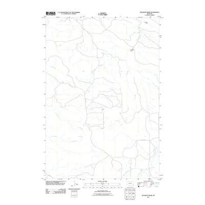
2011 Map of Knudson Draw
USGS Topo · Published 2011About this map
Piniele stands as the central point of interest in this drainage-dominated landscape of southeast Montana. The terrain is defined by the namesake Knudson Draw and a network of seasonal watercourses, including Crow Creek and Scott Creek, which reveal the hydrological patterns of the high plains. Ranching infrastructure is evident through the presence of Whitetail Dam and Selway Spring, suggesting a land shaped by the necessity of water management for livestock. Transportation in this section of Powder River County is limited to gravel routes such as Crow Creek Rd and Box Elder Rd, with Highway 212 cutting across the southwestern corner, connecting this isolated region to the broader state network. The map provides a precise look at the rural land divisions and the few named landmarks that anchor this sparsely populated territory.
Find a feature on this map
13 named features on this map. Tap any name to fly to it.
Don’t see what you’re looking for? This feature index may not catch every label — zoom into the map to look around manually.
Map Details
Editions of this 2011 Knudson Draw Map
This is the sole edition of this map. No revisions or reprints were ever made.
Other maps of this area

1954 · Ekalaka
USGS Topo · 1:250,000

1956 · Ekalaka
USGS Topo · 1:250,000

1958 · Ekalaka
USGS Topo · 1:250,000

1965 · Ekalaka
USGS Topo · 1:250,000
1970 · Belle Creek North
USGS Topo · 1:24,000
1970 · Hammond
USGS Topo · 1:24,000
1970 · Greasy Hill
USGS Topo · 1:24,000

1980 · Broadus
USGS Topo · 1:100,000

1981 · Alzada
USGS Topo · 1:100,000

1982 · Phillippi Reservoir
USGS Topo · 1:24,000