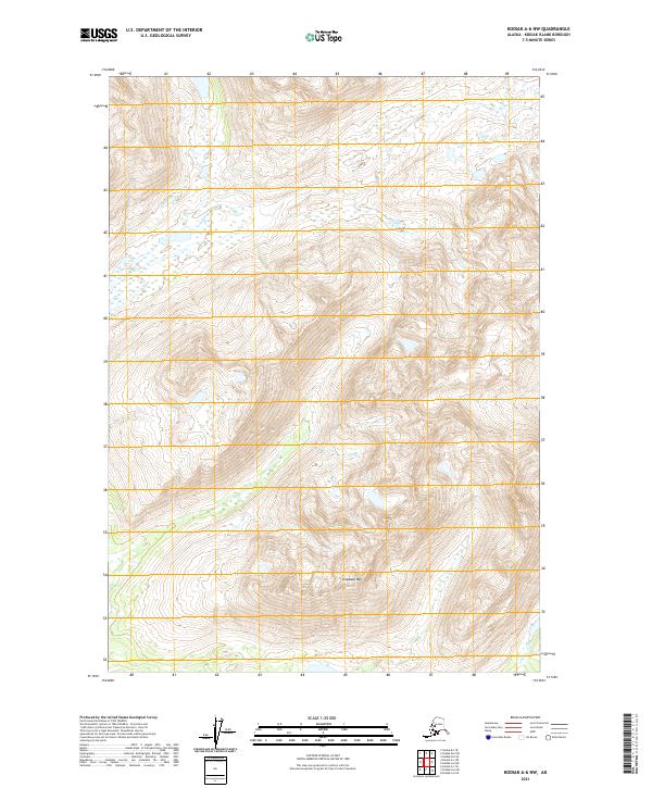
2021 Map of Kodiak A-6 NW
USGS Topo · Published 2021About this map
Grayback Mtn dominates the center of this terrain-focused map of Kodiak Island, which was surveyed with modern precision in 2021. The landscape is characterized by intricate elevation contours that reveal a series of high ridges and deep valleys, largely untouched by developed infrastructure or named roads. The area is gridded by the Public Land Survey System, spanning the boundaries of t34s r30w, t34s r29w, t35s r30w, and t35s r29w. This data provides a technical look at the land's natural architecture, primarily defined by the steep slopes and peaks of the island's interior, offering an essential reference for understanding the physical geography of this part of Alaska's maritime wilderness.
Find a feature on this map
5 named features on this map. Tap any name to fly to it.
Don’t see what you’re looking for? This feature index may not catch every label — zoom into the map to look around manually.
Map Details
Editions of this 2021 Kodiak A-6 NW Map
This is the sole edition of this map. No revisions or reprints were ever made.
Other maps of this area

1951 · Karluk
USGS Topo · 1:250,000

1952 · Kodiak
USGS Topo · 1:250,000

1952 · Karluk
USGS Topo · 1:250,000

1952 · Kodiak B-6
USGS Topo · 1:63,360

1952 · Karluk B-1
USGS Topo · 1:63,360

1952 · Karluk A-1
USGS Topo · 1:63,360

1952 · Kodiak A-6
USGS Topo · 1:63,360
1954 · Karluk A-1
USGS Topo · 1:63,360
1954 · Karluk B-1
USGS Topo · 1:63,360
1954 · Kodiak A-6
USGS Topo · 1:63,360