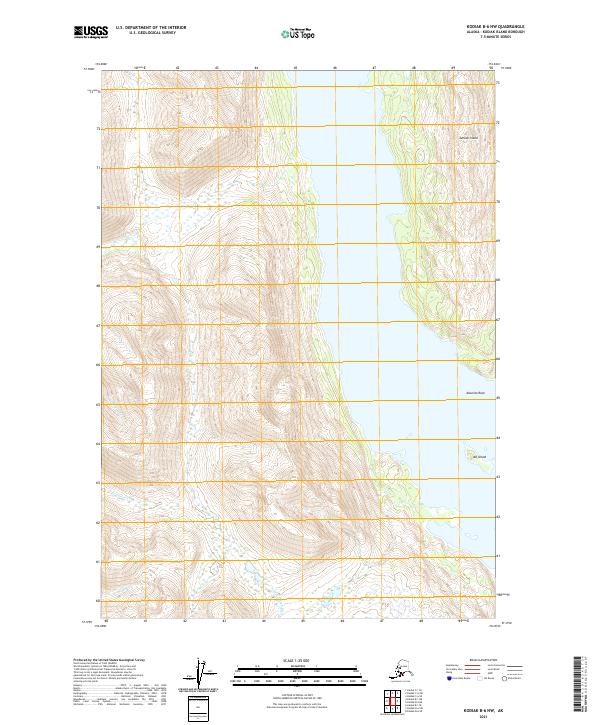
2021 Map of Kodiak B-6 NW
USGS Topo · Published 2021About this map
Amook Island and the neighboring Alf Island define the marine landscape of this coastal quadrangle, where the steep terrain of Kodiak Island meets the sea. Several drainages carve through the high ridges, including Moraine Cr, Cottonwood Cr, and Alder Cr, indicating a rugged watershed system. The southern portion of the sheet is dominated by the North Thumb River, which serves as a significant drainage for the interior highlands. This survey provides a precise look at the township and range boundaries, specifically where T31S and T32S intersect with R28W and R29W. For those studying the coastline, the inclusion of Aleutian Rock provides a key maritime landmark among the intricate contours of the shoreline.
Find a feature on this map
11 named features on this map. Tap any name to fly to it.
Don’t see what you’re looking for? This feature index may not catch every label — zoom into the map to look around manually.
Map Details
Editions of this 2021 Kodiak B-6 NW Map
This is the sole edition of this map. No revisions or reprints were ever made.
Other maps of this area

1951 · Karluk
USGS Topo · 1:250,000

1952 · Kodiak
USGS Topo · 1:250,000

1952 · Karluk
USGS Topo · 1:250,000

1952 · Kodiak B-6
USGS Topo · 1:63,360

1952 · Karluk B-1
USGS Topo · 1:63,360

1952 · Karluk C-1
USGS Topo · 1:63,360

1952 · Kodiak C-6
USGS Topo · 1:63,360
1954 · Kodiak C-6
USGS Topo · 1:63,360
1954 · Karluk C-1
USGS Topo · 1:63,360
1954 · Karluk B-1
USGS Topo · 1:63,360