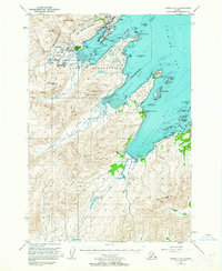
1949 Map of Kodiak C-2
USGS Topo · Published 1964About this map
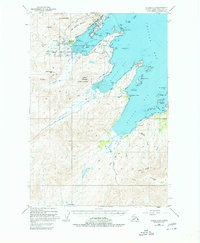
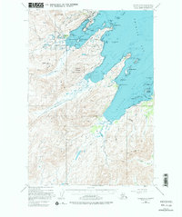
The U S Naval Reservation dominates this post-war coastline of Kodiak Island, illustrating the strategic importance of the area in the late 1940s. Centered around Womens Bay, the map reveals a concentrated military infrastructure including the Military Airport near Abbert and the Military Seaplane Base. Beyond the coastal installations, the landscape rises into the Sargent Range and Old Womens Mountain, where numerous small lakes like Lake Aurel and Lake Phil are tucked into the high terrain. The maritime character of the region is defined by the protected waters of Middle Bay and Kalsin Bay, separated by the prominent Zaimka Ridge. These waters are dotted with hazards and landmarks such as Taller Pinnacle and Svitlak Island, reflecting the intensive hydrographic surveying required for safe navigation along these shores.
Find a feature on this map
57 named features on this map. Tap any name to fly to it.
Don’t see what you’re looking for? This feature index may not catch every label — zoom into the map to look around manually.
Map Details
Editions of this 1949 Kodiak C-2 Map
7 editions found
Other maps of this area

1947 · Kodiak D-3
USGS Topo · 1:63,360

1949 · Kodiak C-2
USGS Topo · 1:63,360

1949 · Kodiak B-1 and B-2
USGS Topo · 1:63,360

1949 · Kodiak D-2
USGS Topo · 1:63,360

1949 · Kodiak D-3
USGS Topo · 1:63,360

1949 · Kodiak C-1
USGS Topo · 1:63,360

1949 · Kodiak B-3
USGS Topo · 1:63,360

1949 · Kodiak D-1
USGS Topo · 1:63,360

1950 · Kodiak B-3
USGS Topo · 1:63,360

1950 · Kodiak D-3
USGS Topo · 1:63,360