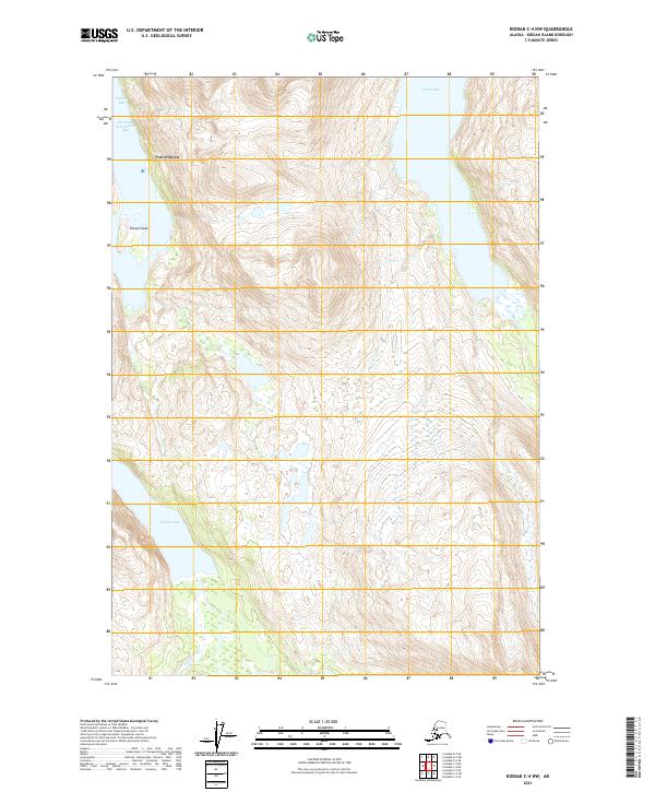
2021 Map of Kodiak C-4 NW
USGS Topo · Published 2021About this map
Port O'Brien sits along the western coast of Kodiak Island, positioned where the Northeast Arm Uganik Bay meets the main waters of Uganik Bay. This 2021 survey illustrates a landscape dominated by deep glacial fjords and high elevations, with Sheep Island providing a prominent landform within the bay's entrance. The interior geography is defined by the drainage systems of Uganik Lake and the Uganik River, which flow through the southwestern portion of the quadrangle.
Find a feature on this map
12 named features on this map. Tap any name to fly to it.
Don’t see what you’re looking for? This feature index may not catch every label — zoom into the map to look around manually.
Map Details
Editions of this 2021 Kodiak C-4 NW Map
This is the sole edition of this map. No revisions or reprints were ever made.
Other maps of this area

1952 · Kodiak
USGS Topo · 1:250,000

1952 · Kodiak C-4
USGS Topo · 1:63,360

1952 · Kodiak C-5
USGS Topo · 1:63,360

1952 · Kodiak D-5
USGS Topo · 1:63,360

1952 · Kodiak D-4
USGS Topo · 1:63,360
1954 · Kodiak C-4
USGS Topo · 1:63,360
1954 · Kodiak D-5
USGS Topo · 1:63,360
1954 · Kodiak D-4
USGS Topo · 1:63,360
1954 · Kodiak C-5
USGS Topo · 1:63,360
1965 · Kodiak D-4
USGS Topo · 1:63,360