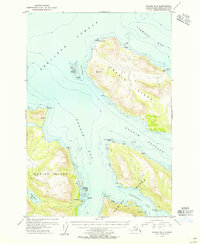
1954 Map of Kodiak D-5
USGS Topo · Published 1955About this map
Uganik Island dominates this mid-century coastal survey, separated from the larger Kodiak Island landmass by the waters of Uganik Passage and the Uganik Bay. The terrain is characterized by coastal activity and isolated outposts within the Kodiak National Wildlife Refuge. Traces of the local maritime economy are evident at the Cannery located south of the Village Islands, while scattered Cabin labels and Cabins near Starr Pt suggest seasonal use or remote dwellings along the shoreline. Dramatic coastal features like Cape Uganik and the Noisy Islands frame the entrance to Shelikof Strait, highlighting the navigational hazards and landmarks known to mariners in the Viekoda Bay area before modern development changed the island's coastline.
Find a feature on this map
33 named features on this map. Tap any name to fly to it.
Don’t see what you’re looking for? This feature index may not catch every label — zoom into the map to look around manually.
Map Details
Editions of this 1954 Kodiak D-5 Map
This is the sole edition of this map. No revisions or reprints were ever made.
Other maps of this area

1951 · Kodiak D-6
USGS Topo · 1:63,360

1952 · Kodiak
USGS Topo · 1:250,000

1952 · Afognak
USGS Topo · 1:250,000

1952 · Afognak A-4
USGS Topo · 1:63,360

1952 · Kodiak C-4
USGS Topo · 1:63,360

1952 · Kodiak C-5
USGS Topo · 1:63,360

1952 · Kodiak D-5
USGS Topo · 1:63,360

1952 · Kodiak C-6
USGS Topo · 1:63,360
1952 · Afognak A-5
USGS Topo · 1:63,360

1952 · Kodiak D-4
USGS Topo · 1:63,360