
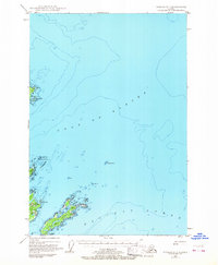
1949 Map of Kodiak D-1
USGS Topo · Published 1965About this map
Woody Island and Long Island anchor this hydrographic and topographic study of the coastal waters where the Gulf of Alaska meets the Pacific Ocean. Based on 1947 aerial photography and 1949 field checks, the map captures a network of maritime aids and geographical landmarks essential for mid-century navigation. Small freshwater bodies like Elephant Lake on Woody Island and Dolgoi Lake on Long Island sit in contrast to the surrounding saltwater reefs and bays. Notable navigational features include Hamin Rocks Light and prominent Radio Towers, which served as vital coordinates for vessels moving through these northern waters. The map details a landscape defined by offshore hazards like Williams Reef and Hutchinson Reef, reflecting the region's reliance on precise maritime charting during the post-war era.
Find a feature on this map
22 named features on this map. Tap any name to fly to it.
Don’t see what you’re looking for? This feature index may not catch every label — zoom into the map to look around manually.
Map Details
Editions of this 1949 Kodiak D-1 Map
2 editions found
Other maps of this area

1949 · Kodiak C-2
USGS Topo · 1:63,360

1949 · Kodiak D-2
USGS Topo · 1:63,360

1949 · Kodiak C-1
USGS Topo · 1:63,360

1951 · Kodiak D-1
USGS Topo · 1:63,360

1951 · Kodiak D-2
USGS Topo · 1:63,360

1951 · Kodiak C-1
USGS Topo · 1:63,360

1952 · Kodiak
USGS Topo · 1:250,000

1952 · Afognak
USGS Topo · 1:250,000

1952 · Afognak A-1
USGS Topo · 1:63,360

1952 · Afognak A-2
USGS Topo · 1:63,360