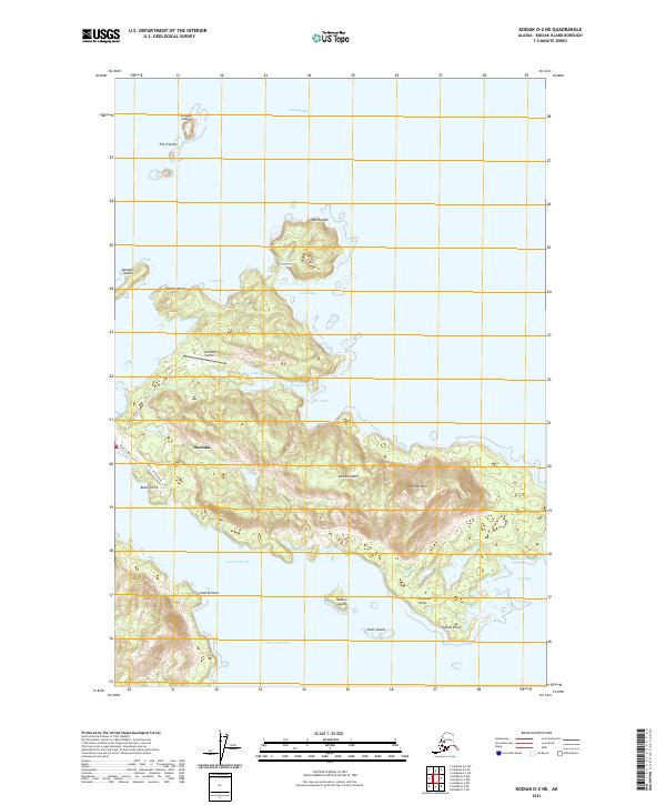
2021 Map of Kodiak D-2 NE
USGS Topo · Published 2021About this map
Ouzinkie occupies the western edge of Spruce Island, a landscape defined by deep maritime indentations and the high peak of Mt Herman. The community's infrastructure is tightly concentrated, connected by Airport Road and Third Street to the Ouzinkie Airport. This coastal geography relies on protected water bodies like Balika Cove and Knee Bay for shelter from the open waters of Marmot Bay to the north.
Find a feature on this map
33 named features on this map. Tap any name to fly to it.
Don’t see what you’re looking for? This feature index may not catch every label — zoom into the map to look around manually.
Map Details
Editions of this 2021 Kodiak D-2 NE Map
This is the sole edition of this map. No revisions or reprints were ever made.
Other maps of this area

1949 · Kodiak D-2
USGS Topo · 1:63,360

1949 · Kodiak D-1
USGS Topo · 1:63,360

1951 · Kodiak D-1
USGS Topo · 1:63,360

1951 · Kodiak D-2
USGS Topo · 1:63,360

1952 · Kodiak
USGS Topo · 1:250,000

1952 · Afognak
USGS Topo · 1:250,000

1952 · Afognak A-1
USGS Topo · 1:63,360

1952 · Afognak A-2
USGS Topo · 1:63,360
1953 · Afognak A-1
USGS Topo · 1:63,360
1954 · Afognak A-2
USGS Topo · 1:63,360