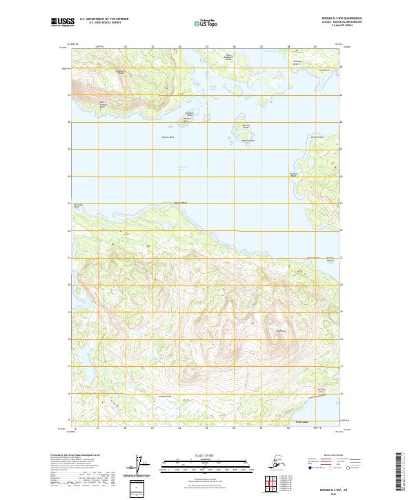
2021 Map of Kodiak D-3 NW
USGS Topo · Published 2021About this map
Port Lions serves as the primary settlement on this portion of Kodiak Island, situated along the southern shore of the Kupreanof Strait. The village is connected to the Port Lions Airport via Airport Road, illustrating the essential role of air transport for this coastal community. The surrounding landscape is defined by a complex network of waterways and islands, including Raspberry Island to the north and smaller landmasses like Deranof Island and Nachalni Island which guard the entrance to The Slough.
Find a feature on this map
28 named features on this map. Tap any name to fly to it.
Don’t see what you’re looking for? This feature index may not catch every label — zoom into the map to look around manually.
Map Details
Editions of this 2021 Kodiak D-3 NW Map
This is the sole edition of this map. No revisions or reprints were ever made.
Other maps of this area

1947 · Kodiak D-3
USGS Topo · 1:63,360

1949 · Kodiak D-3
USGS Topo · 1:63,360

1950 · Kodiak D-3
USGS Topo · 1:63,360

1952 · Kodiak
USGS Topo · 1:250,000

1952 · Afognak
USGS Topo · 1:250,000

1952 · Afognak A-4
USGS Topo · 1:63,360

1952 · Afognak A-3
USGS Topo · 1:63,360

1952 · Kodiak D-4
USGS Topo · 1:63,360

1953 · Afognak A-4
USGS Topo · 1:63,360
1954 · Afognak A-3
USGS Topo · 1:63,360