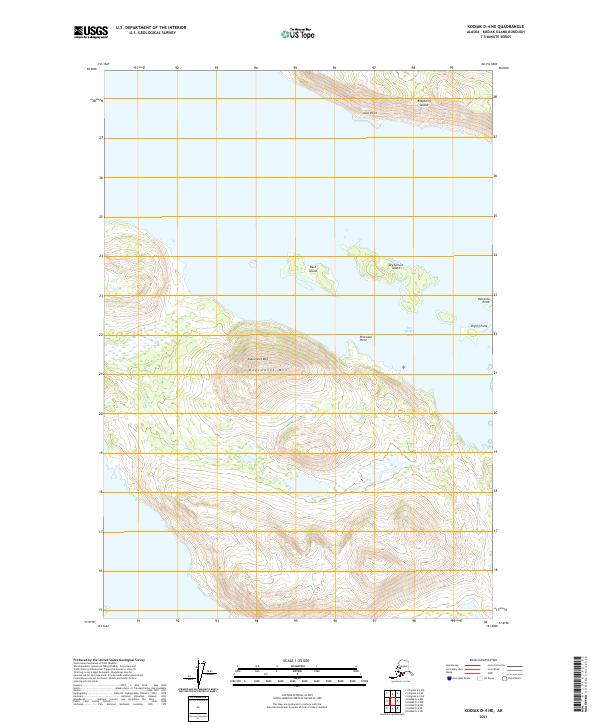
2021 Map of Kodiak D-4 NE
USGS Topo · Published 2021About this map
Kupreanof Mtn dominates this coastal region of Kodiak Island, rising sharply above the complex marine environment of the North Pacific. The landscape is defined by its maritime geography, where narrow passages separate the mainland from substantial landmasses like Raspberry Island and smaller outcrops such as Bare Island and Dry Spruce Island. The topography here is steep and transitionary, moving from the high elevations of the inland peaks down to specific coastal markers like Gori Point and Perenosa Point. Within Dry Spruce Bay, the tides and currents are suggested by features like Drying Point and Ostrovka Point, which delineate the shifting boundary between land and water. This area represents a rugged island ecosystem where terrestrial heights and sheltered bays create a classic Alaskan coastal profile.
Find a feature on this map
13 named features on this map. Tap any name to fly to it.
Don’t see what you’re looking for? This feature index may not catch every label — zoom into the map to look around manually.
Map Details
Editions of this 2021 Kodiak D-4 NE Map
This is the sole edition of this map. No revisions or reprints were ever made.
Other maps of this area

1947 · Kodiak D-3
USGS Topo · 1:63,360

1949 · Kodiak D-3
USGS Topo · 1:63,360

1950 · Kodiak D-3
USGS Topo · 1:63,360

1952 · Kodiak
USGS Topo · 1:250,000

1952 · Afognak
USGS Topo · 1:250,000

1952 · Afognak A-4
USGS Topo · 1:63,360

1952 · Afognak A-3
USGS Topo · 1:63,360

1952 · Kodiak D-4
USGS Topo · 1:63,360

1953 · Afognak A-4
USGS Topo · 1:63,360
1954 · Afognak A-3
USGS Topo · 1:63,360