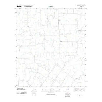
2010 Map of Komensky
USGS Topo · Published 2010About this map
Novohrad, Komensky, and Witting serve as the primary focal points for this rural pocket of Lavaca County, where the landscape is defined by the complex drainage network of the Lavaca River and its numerous tributaries. The map details a pastoral environment shaped by the North Fork Lavaca River and Smothers Creek, showing a dense grid of county roads that connect isolated farmsteads and historic community centers. Genealogists will find particular value in the locations of the Baursville Cemetery and Breslau Cemetery, which remain as physical markers of the area's early Central European settlement patterns. This 2010 survey reflects the enduring agricultural character of the region, where the winding courses of Liveoak Creek and Big Rocky Creek continue to dictate the placement of local infrastructure and property boundaries in a landscape largely unchanged by modern urban expansion.
Find a feature on this map
54 named features on this map. Tap any name to fly to it.
Don’t see what you’re looking for? This feature index may not catch every label — zoom into the map to look around manually.
Map Details
Editions of this 2010 Komensky Map
This is the sole edition of this map. No revisions or reprints were ever made.
Other maps of this area

1901 · Flatonia
USGS Topo · 1:125,000

1919 · Schulenburg
USGS Topo · 1:62,500

1953 · Seguin
USGS Topo · 1:250,000

1958 · Seguin
USGS Topo · 1:250,000

1962 · Hallettsville
USGS Topo · 1:24,000

1965 · Schulenburg
USGS Topo · 1:24,000

1965 · Wied
USGS Topo · 1:24,000

1965 · Komensky
USGS Topo · 1:24,000
1965 · Moravia
USGS Topo · 1:24,000

1965 · Flatonia
USGS Topo · 1:24,000