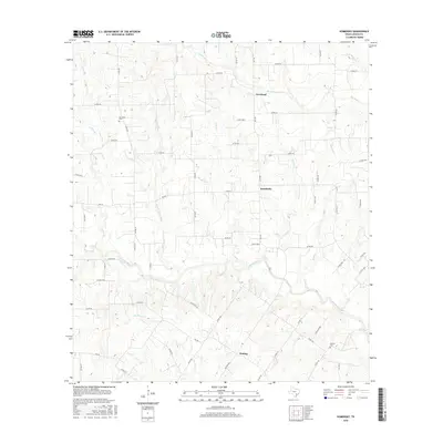
2016 Map of Komensky
USGS Topo · Published 2016About this map
Novohrad, Komensky, and Witting anchor this portion of Lavaca County, where a network of farm-to-market roads and county routes follows the undulating drainage patterns of the Texas coastal plains. The topography is defined by the southeasterly flow of the Lavaca River and its numerous tributaries, including N Fork Lavaca River and Big Rocky Cr. These waterways dictate the placement of local infrastructure, with many homesteads and secondary roads situated on the higher ground between creek beds like Smothers Cr and Boggy Cr. Local history is preserved at the Baursville Cem and Breslau Cem, which serve as quiet landmarks for genealogists tracing families in these rural communities. The map reflects a landscape deeply tied to its agrarian roots, with a dispersed settlement pattern that has remained largely unchanged by large-scale urbanization into the 21st century.
Find a feature on this map
63 named features on this map. Tap any name to fly to it.
Don’t see what you’re looking for? This feature index may not catch every label — zoom into the map to look around manually.
Map Details
Editions of this 2016 Komensky Map
This is the sole edition of this map. No revisions or reprints were ever made.
Other maps of this area

1901 · Flatonia
USGS Topo · 1:125,000

1919 · Schulenburg
USGS Topo · 1:62,500

1953 · Seguin
USGS Topo · 1:250,000

1958 · Seguin
USGS Topo · 1:250,000

1962 · Hallettsville
USGS Topo · 1:24,000

1965 · Schulenburg
USGS Topo · 1:24,000

1965 · Wied
USGS Topo · 1:24,000

1965 · Komensky
USGS Topo · 1:24,000
1965 · Moravia
USGS Topo · 1:24,000

1965 · Flatonia
USGS Topo · 1:24,000