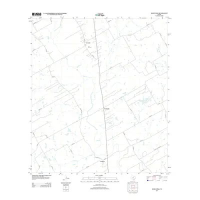
2013 Map of Kosciusko
USGS Topo · Published 2013About this map
Cestohowa and Kosciusko anchor this rural landscape in Karnes County, reflecting the deep-rooted agricultural and cultural heritage of the region's Polish settlements. The terrain is defined by the winding course of Cibolo Cr and its numerous tributaries, including Pulaski Cr, Biala Cr, and Dry Cr. These waterways, alongside managed water features like Olinick Reservoir and the twin Pawelek Lake Number 1 and Pawelek Lake Number 2, illustrate a landscape meticulously adapted for ranching and farming. Local history is physically preserved at Saint Anns Cem near the northern settlement, while the road network of Farm-to-Market routes and county lanes, such as Farm Road 3191 and FM-541, connects the hamlets of Pawelekville to the surrounding cattle country. The presence of Costilla Petrolem Rd in the southeast points to the persistent intersection of the local petroleum industry and traditional land use.
Find a feature on this map
43 named features on this map. Tap any name to fly to it.
Don’t see what you’re looking for? This feature index may not catch every label — zoom into the map to look around manually.
Map Details
Editions of this 2013 Kosciusko Map
This is the sole edition of this map. No revisions or reprints were ever made.
Other maps of this area

1920 · Smiley
USGS Topo · 1:125,000

1925 · Tordia No. 1
USGS Topo · 1:48,000

1931 · Falls City
USGS Topo · 1:62,500

1936 · Floresville
USGS Topo · 1:62,500

1953 · Crystal City
USGS Topo · 1:250,000

1953 · Beeville
USGS Topo · 1:250,000

1953 · Seguin
USGS Topo · 1:250,000

1954 · San Antonio
USGS Topo · 1:250,000

1955 · Crystal City
USGS Topo · 1:250,000

1956 · Beeville
USGS Topo · 1:250,000