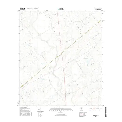
2016 Map of Kosciusko
USGS Topo · Published 2016About this map
Cibolo Creek meanders through the heart of this landscape along the border of Wilson and Karnes Counties, anchoring a region defined by its rural Polish-Texan heritage. The small settlements of Kosciusko, Pawelekville, and Cestohowa are the primary focal points of this community, connected by a network of Farm to Market roads. Near Kosciusko, the Saint Anns Cem stands as a significant genealogical landmark for local families. The terrain is marked by numerous seasonal drainages including Pulaski Cr, Biala Cr, and Multifest Cr, which feed into the primary creek system. Managed water resources like the Olinick Reservoir and the Pawelek Lake Number 1 indicate the area's agricultural reliance on water conservation. This survey provides a clear view of the property divisions and road networks that have structured these rural communities into the modern era.
Find a feature on this map
46 named features on this map. Tap any name to fly to it.
Don’t see what you’re looking for? This feature index may not catch every label — zoom into the map to look around manually.
Map Details
Editions of this 2016 Kosciusko Map
This is the sole edition of this map. No revisions or reprints were ever made.
Other maps of this area

1920 · Smiley
USGS Topo · 1:125,000

1925 · Tordia No. 1
USGS Topo · 1:48,000

1931 · Falls City
USGS Topo · 1:62,500

1936 · Floresville
USGS Topo · 1:62,500

1953 · Crystal City
USGS Topo · 1:250,000

1953 · Beeville
USGS Topo · 1:250,000

1953 · Seguin
USGS Topo · 1:250,000

1954 · San Antonio
USGS Topo · 1:250,000

1955 · Crystal City
USGS Topo · 1:250,000

1956 · Beeville
USGS Topo · 1:250,000