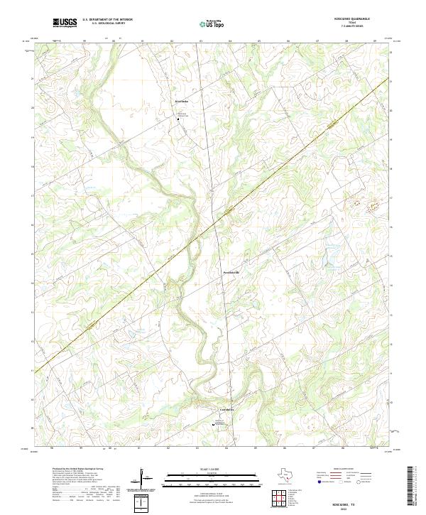
2022 Map of Kosciusko
USGS Topo · Published 2022About this map
Cestohowa and Kosciusko anchor this rural landscape along the boundary between Wilson and Karnes counties. The area is defined by a series of waterways, most notably Cibolo Cr, which winds through the center of the sheet alongside tributaries like Pulaski Cr and Casiano Cr. This region reflects a deeply rooted community structure, evidenced by the central presence of the Nativity of the Blessed Virgin Mary Cem in Cestohowa and the Saint Anns Catholic Cem in Kosciusko. Small-scale water management is visible through features such as the Olinick Reservoir and the Pawelek Lake Number 1 complex near Pawelekville. The map captures a contemporary look at the ranching and agricultural lands of South Texas, where a dense network of county roads and farm-to-market routes connects historically Polish-settled communities.
Find a feature on this map
49 named features on this map. Tap any name to fly to it.
Don’t see what you’re looking for? This feature index may not catch every label — zoom into the map to look around manually.
Map Details
Editions of this 2022 Kosciusko Map
This is the sole edition of this map. No revisions or reprints were ever made.
Other maps of this area

1920 · Smiley
USGS Topo · 1:125,000

1925 · Tordia No. 1
USGS Topo · 1:48,000

1931 · Falls City
USGS Topo · 1:62,500

1936 · Floresville
USGS Topo · 1:62,500

1953 · Crystal City
USGS Topo · 1:250,000

1953 · Beeville
USGS Topo · 1:250,000

1953 · Seguin
USGS Topo · 1:250,000

1954 · San Antonio
USGS Topo · 1:250,000

1955 · Crystal City
USGS Topo · 1:250,000

1956 · Beeville
USGS Topo · 1:250,000