
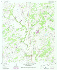
1960 Map of Kosciusko
USGS Topo · Published 1961About this map
The agricultural lands of the Texas coastal plain are defined here by the winding course of Cibolo Creek, which carves a path through the borderlands of Wilson and Karnes counties. Small rural settlements established by Polish immigrants, such as Kosciusko and Cestohowa, anchor the landscape around central parish landmarks like St Anns Ch and St Anns Cem. The presence of Pulaski Sch along the creek of the same name illustrates the dispersed educational network of the mid-century, while a network of pipelines and scattered oil wells reflects the region's mineral interests. The terrain is further etched by numerous tributaries, including Riala Creek, Casiano Creek, and Mulifest Creek, supporting a mix of ranching and early industrial sites like the several quarries located near Pawelekville.
Find a feature on this map
22 named features on this map. Tap any name to fly to it.
Don’t see what you’re looking for? This feature index may not catch every label — zoom into the map to look around manually.
Map Details
Editions of this 1960 Kosciusko Map
2 editions found
Other maps of this area

1920 · Smiley
USGS Topo · 1:125,000

1925 · Tordia No. 1
USGS Topo · 1:48,000

1931 · Falls City
USGS Topo · 1:62,500

1936 · Floresville
USGS Topo · 1:62,500

1953 · Crystal City
USGS Topo · 1:250,000

1953 · Beeville
USGS Topo · 1:250,000

1953 · Seguin
USGS Topo · 1:250,000

1954 · San Antonio
USGS Topo · 1:250,000

1955 · Crystal City
USGS Topo · 1:250,000

1956 · Beeville
USGS Topo · 1:250,000