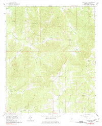
1964 Map of Kosciusko NE
USGS Topo · Published 1982About this map
The rolling woodlands and creek valleys of Attala County are defined by a network of rural churches and family cemeteries in the early 1960s. Waterways like Zilpha Creek and its tributary Little Zilpha Creek cut through the northern terrain, while Scoobachita Creek and Sugar Creek drain the western reaches. This landscape reflects a deeply established agrarian community, where landmarks such as New Salem Ch and Pilgrim Rest Ch serve as central gathering points for dispersed farmsteads.
Find a feature on this map
21 named features on this map. Tap any name to fly to it.
Don’t see what you’re looking for? This feature index may not catch every label — zoom into the map to look around manually.
Map Details
Editions of this 1964 Kosciusko NE Map
Other maps of this area

1953 · West Point
USGS Topo · 1:250,000

1958 · West Point
USGS Topo · 1:250,000

1963 · West Point
USGS Topo · 1:250,000

1964 · Kosciusko NE
USGS Topo · 1:24,000

1964 · Hesterville
USGS Topo · 1:24,000

1964 · Kosciusko
USGS Topo · 1:24,000
1964 · McAdams
USGS Topo · 1:24,000

1966 · Poplar Creek
USGS Topo · 1:24,000

1966 · Kosciusko
USGS Topo · 1:62,500

1966 · French Camp
USGS Topo · 1:24,000