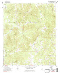
1964 Map of Kosciusko NE
USGS Topo · Published 1982About this map
The upper headwaters of Scoobachita Creek and Zilpha Creek define this rural landscape in northeastern Attala County, where mid-century life revolved around a network of country churches and family burial grounds. The land is marked by numerous small, established spiritual centers including New Salem Ch, Oak Grove Ch, and Shady Grove Ch, often accompanied by their respective cemeteries such as Newhope Cem and Pierce Chapel Cem. These landmarks serve as critical anchors for genealogists tracing family roots in the Mississippi hill country.
Find a feature on this map
22 named features on this map. Tap any name to fly to it.
Don’t see what you’re looking for? This feature index may not catch every label — zoom into the map to look around manually.
Map Details
Editions of this 1964 Kosciusko NE Map
Other maps of this area

1953 · West Point
USGS Topo · 1:250,000

1958 · West Point
USGS Topo · 1:250,000

1963 · West Point
USGS Topo · 1:250,000

1964 · Kosciusko NE
USGS Topo · 1:24,000

1964 · Hesterville
USGS Topo · 1:24,000

1964 · Kosciusko
USGS Topo · 1:24,000
1964 · McAdams
USGS Topo · 1:24,000

1966 · Poplar Creek
USGS Topo · 1:24,000

1966 · Kosciusko
USGS Topo · 1:62,500

1966 · French Camp
USGS Topo · 1:24,000