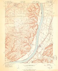
1951 Map of Kosmosdale
USGS Topo · Published 1951About this map
The Ohio River forms a wide, meandering boundary between the hills of Indiana and the expanding infrastructure of Kentucky in the early 1950s. On the Kentucky side, the Dixie Highway and the Illinois Central railroad anchor a corridor of small communities including Kosmosdale and Orell. This area is characterized by a transition from industrial and river-oriented settlements to the controlled lands of the Fort Knox Military Reservation and the Knob Creek Naval Reservation to the south.
Find a feature on this map
65 named features on this map. Tap any name to fly to it.
Don’t see what you’re looking for? This feature index may not catch every label — zoom into the map to look around manually.
Map Details
Editions of this 1951 Kosmosdale Map
2 editions found
Other maps of this area

1909 · Kosmosdale
USGS Topo · 1:48,000

1912 · Kosmosdale
USGS Topo · 1:62,500

1931 · Corydon
USGS Topo · 1:62,500

1936 · Vine Grove
USGS Topo · 1:62,500

1941 · Ekron
USGS Topo · 1:62,500

1943 · Vine Grove
USGS Topo · 1:62,500

1946 · Rock Haven
USGS Topo · 1:24,000

1946 · Pitts Point
USGS Topo · 1:24,000

1946 · Fort Knox
USGS Topo · 1:24,000

1946 · Vine Grove
USGS Topo · 1:62,500