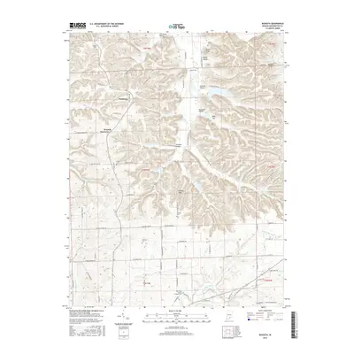
2016 Map of Kossuth
USGS Topo · Published 2016About this map
The ridge-and-hollow terrain of Washington County dominates this landscape, where the small communities of Plattsburg and Kossuth are situated among a complex network of named valleys. Significant local history is preserved in the distribution of family and community burial grounds, including the Blue River Quaker Orthodox Cem and the Nicholson Cem. The topography is defined by prominent elevations like Potato Knob and Johnson Knob, while drainage flows through numerous hollows such as Lick Skillet Hollow and Mandy Hollow. The area is characterized by a winding road system following the contours of Walnut Ridge and the watercourse of the W Fork Blue River, illustrating the traditional rural settlement patterns of southern Indiana. The presence of numerous cemeteries like Ridlen Cem and Peugh Cem near established farmsteads offers valuable points of reference for genealogical research.
Find a feature on this map
88 named features on this map. Tap any name to fly to it.
Don’t see what you’re looking for? This feature index may not catch every label — zoom into the map to look around manually.
Map Details
Editions of this 2016 Kossuth Map
This is the sole edition of this map. No revisions or reprints were ever made.
Other maps of this area

1950 · Salem
USGS Topo · 1:24,000

1950 · Becks Mill
USGS Topo · 1:24,000

1951 · Smedley
USGS Topo · 1:24,000

1953 · Kossuth
USGS Topo · 1:24,000

1955 · South Boston
USGS Topo · 1:24,000

1956 · Vincennes
USGS Topo · 1:250,000

1956 · Louisville
USGS Topo · 1:250,000

1957 · Vincennes
USGS Topo · 1:250,000

1958 · Vincennes
USGS Topo · 1:250,000

1958 · Little York
USGS Topo · 1:24,000